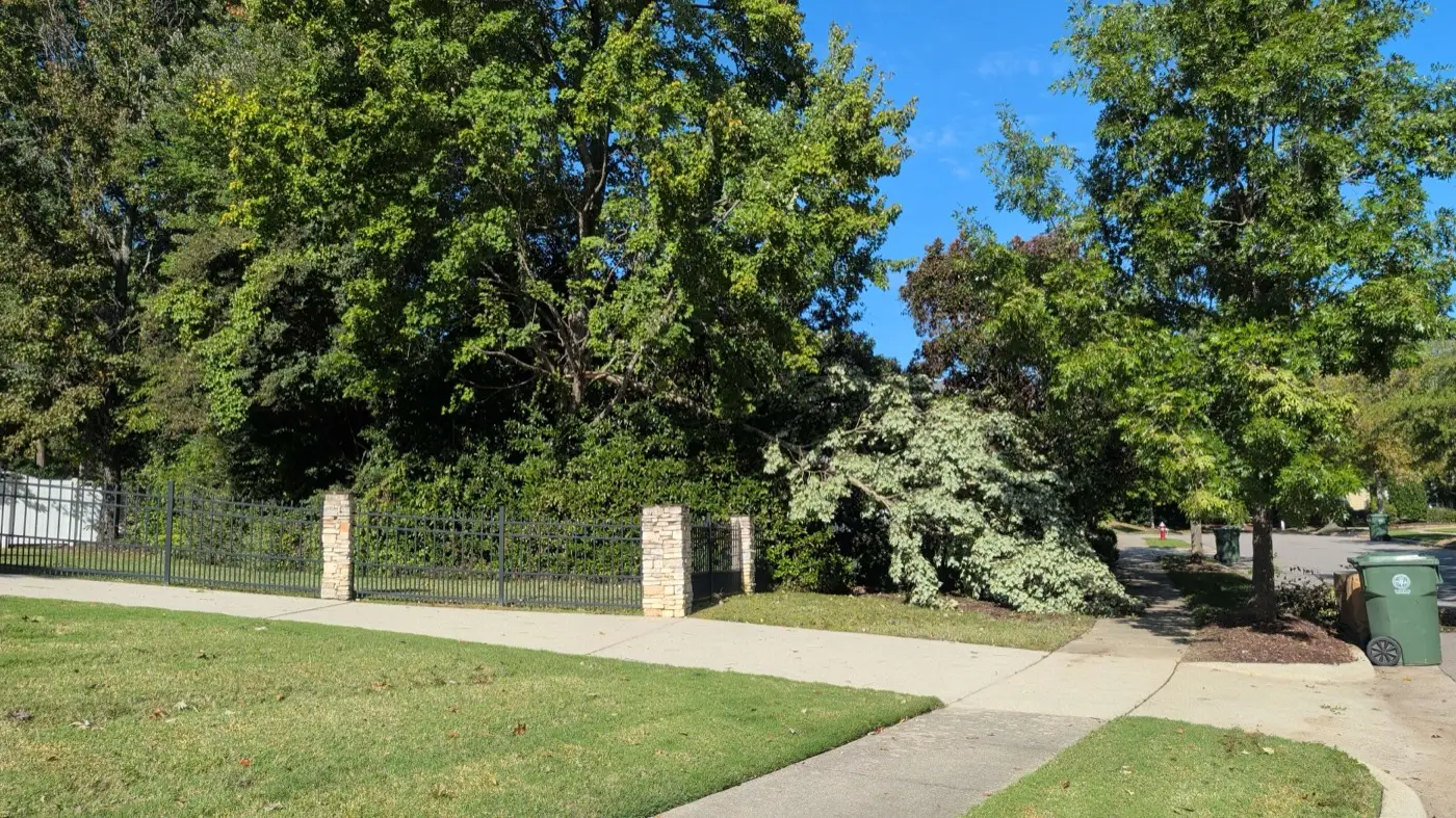
An EF1 tornado with 100 mph winds touched down by the West Regional Library in west Cary on Sunday, Oct. 11, the weather service says. It snapped trees but caused no structural damage.
A tornado touched down in west Cary on Sunday, Oct. 11, the National Weather Service has confirmed. Surveyors rated it EF1, with peak winds estimated at 100 mph.
It formed near the West Regional Library on Morrisville Parkway at 12:29 p.m. and lifted a minute later. It traveled about a third of a mile northeast. No one was hurt.
The National Weather Service in Raleigh published its damage survey at 3:16 p.m. Tuesday. It is the only tornado the weather service has confirmed in Cary from Sunday’s storms.
What the survey found
The survey’s key figures:
- Rating: EF1, the second-lowest on the Enhanced Fujita scale, which covers winds of 86 to 110 mph
- Peak wind: about 100 mph
- Path: 0.37 miles long and up to 50 yards wide
- Time: 12:29 to 12:30 p.m.
- Injuries and deaths: none
A large tree was snapped in the library parking lot. Surveyors also found tree limbs 1 to 3 inches thick snapped and scattered through the neighborhood north of the library.
They found no damage to buildings. The weather service said that suggests “the strongest winds remained just above ground affecting mainly treetops.”
The survey’s damage points are mapped in the weather service’s Damage Assessment Toolkit. One note there says the library tree, about 14 inches across, snapped about 10 feet off the ground. Surveyors judged it was at least partly rotted, so they rated that spot at a slightly lower wind speed.
The weather service calls the findings preliminary. They can change before the event is published in its Storm Data record.
What this changes from our first report
On Monday we reported a member of the public’s tornado report about a mile east of Carpenter at 12:32 p.m. The survey confirms a tornado in that spot.
A second public report, about 4 miles southwest of Carpenter, has no survey of its own. The weather service has not confirmed a tornado there.
The other tornadoes Sunday
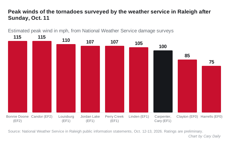
The Raleigh office surveyed nine tornadoes from Sunday’s storms by Tuesday night. The nearest to Cary crossed the southeast corner of Jordan Lake in Chatham County, about 12 miles southwest, at 12:02 p.m. Surveyors rated it EF1 with winds of 107 mph.
The Perry Creek tornado was the only other one in Wake County. It started about 3 miles north of New Hope, northeast of Raleigh.
| Tornado | County | Rating | Peak wind | Path length |
|---|---|---|---|---|
| Bonnie Doone | Cumberland | EF2 | 115 mph | 5.30 miles |
| Candor | Montgomery | EF2 | 115 mph | 0.38 miles |
| Louisburg | Franklin | EF1 | 110 mph | 1.93 miles |
| Jordan Lake | Chatham | EF1 | 107 mph | 1.07 miles |
| Perry Creek | Wake | EF1 | 107 mph | 2.51 miles |
| Linden | Cumberland | EF1 | 105 mph | 1.18 miles |
| Carpenter, Cary | Wake | EF1 | 100 mph | 0.37 miles |
| Clayton | Johnston | EF0 | 85 mph | 3.33 miles |
| Harrells | Sampson | EF0 | 75 mph | 0.18 miles |
The figures come from the weather service’s public information statements issued Oct. 12 and 13.
What it means for you
- Tree damage on your property: call your homeowners insurer before you hire a tree service, and take photos first.
- Limbs or trees in the street: call Cary 311 or 919-469-4000.
- A downed power line: call 911 and stay away from it. Our power outages page has the Duke Energy numbers.
- Storm debris at the curb: our trash and recycling page explains how yard waste pickup works in Cary.
A tornado warning was issued for Cary at 12:12 p.m., 17 minutes before the tornado formed.
Have your say