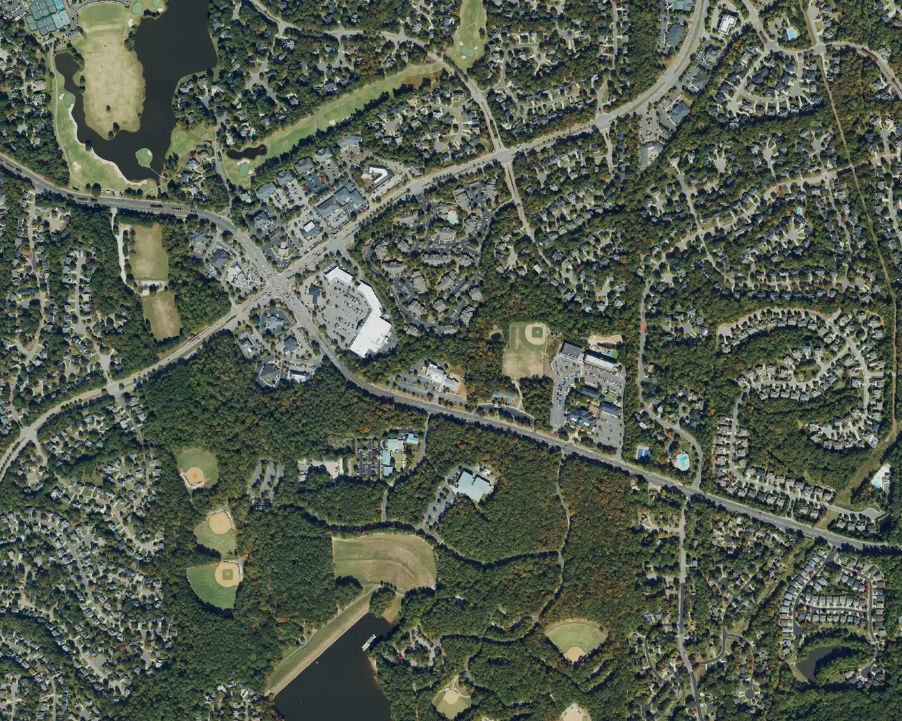
Ten Cary areas from downtown to Green Level: ZIP codes, zoned high schools, August 2026 home values and how school zones cross town lines.
Last checked Oct. 12, 2026. Sources: the Town of Cary’s Imagine Cary Community Plan and open data (residential boundaries, corporate limits), the Wake County Public School System’s 2026-27 attendance areas, the N.C. Department of Public Instruction’s 2025-26 accountability data, the U.S. Census Bureau, OpenStreetMap and Zillow Research.
Cary covers about 62.4 square miles, according to the town’s corporate limits data, and had 179,306 residents in the Census Bureau’s 2020-2024 American Community Survey (QuickFacts). Most of the town is in Wake County; a western section is in Chatham County. The town’s Imagine Cary Community Plan says Cary “in many respects is a multi-centered community,” with “several major commercial centers located throughout Town.”
Four things shape where people live:
- The main roads. Interstate 40 runs along the north and east sides, U.S. 1 and U.S. 64 cross the south, and N.C. 540, the Triangle Expressway toll road, runs down the west side. Downtown sits in the middle, on Chatham and Academy streets, with the Amtrak station.
- ZIP codes. The town’s main ZIP codes are 27511 (downtown, central and east Cary), 27513 (north and northwest), 27518 (south) and 27519 (west). Some Cary homes have Morrisville 27560 or Apex 27523 addresses. Check a parcel on Wake County’s iMAPS map.
- School zones do not follow town limits. The Wake County Public School System assigns each address a base school. Lochmere, inside Cary, is zoned for Athens Drive High in Raleigh; part of MacGregor Downs is zoned for Apex High. Homes in the Chatham County part of Cary, including part of Amberly, are served by Chatham County Schools.
- Planned communities and planning areas. The town’s plan names Kildaire Farms, Lochmere and Cary Park as large master-planned neighborhoods, and draws special planning areas for Downtown, the Eastern Cary Gateway, Historic Carpenter and Green Level.
The areas at a glance
Zoned high school is the one most homes in the area were zoned for in the district’s 2026-27 attendance areas; check every address in the base school lookup. Home value is the Zillow Home Value Index for the area’s main ZIP code in August 2026, a modeled typical value, not a sale price.
| Area | Main ZIP | Zoned high school | ZIP home value, Aug. 2026 | Guide |
|---|---|---|---|---|
| Downtown | 27511 | Cary High | $496,081 | Downtown |
| Eastern Cary Gateway | 27511 | Cary High | $496,081 | Eastern Cary Gateway |
| Kildaire Farms | 27511 | Cary High | $496,081 | Kildaire Farms |
| MacGregor Downs | 27511 | Cary High | $496,081 | MacGregor Downs |
| Lochmere | 27518 | Athens Drive High | $734,578 | Lochmere |
| Weston | 27513 | Cary High | $556,721 | Weston |
| Preston | 27513 | Green Hope High | $556,721 | Preston |
| Carpenter | 27519 | Green Hope High | $695,323 | Carpenter |
| Amberly | 27519 | Panther Creek High | $695,323 | Amberly |
| Green Level | 27519 | Green Level High | $695,323 | Green Level |
For the whole town, Zillow’s figure was $619,636 in August 2026, down 1.4% from August 2025. More on prices in our home prices guide and on schools in our schools guide.
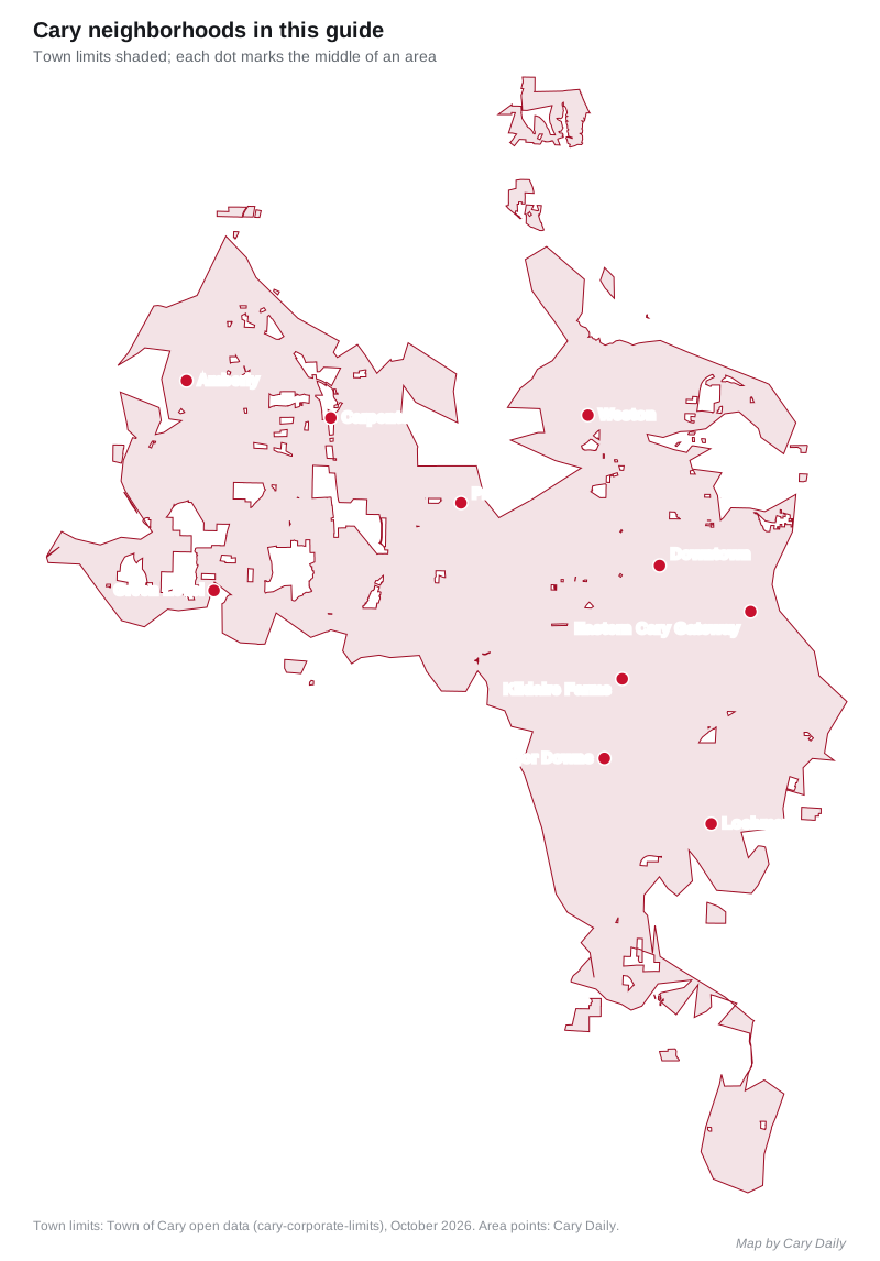
Map
Downtown
The town’s historic center along Chatham and Academy streets, with the Amtrak station, Downtown Cary Park and older, mostly low-density neighborhoods around it. Zoned for Cary High; ZIP codes 27511 and 27513. Read the Downtown guide.
Eastern Cary Gateway
About 800 acres along I-40 on Cary’s eastern border, with WakeMed Soccer Park, Adams Elementary, apartments, townhomes and mobile home parks. The town’s plan says nearly half of the commuters entering and leaving Cary travel through it. Zoned for Cary High; ZIP code 27511. Read the Eastern Cary Gateway guide.
Kildaire Farms
The master-planned area along Kildaire Farm Road south of downtown, with shopping centers along the road and GoCary Route 5. All 53 neighborhoods we checked were zoned for Cary High. Read the Kildaire Farms guide.
MacGregor Downs
A neighborhood built around a lake and the MacGregor Downs Country Club golf course, north of U.S. 1/U.S. 64 and about a mile from the Tryon Road exit. Mostly zoned for Cary High; MacGregor West is zoned for Apex High. Read the MacGregor Downs guide.
Lochmere
A master-planned area in southeast Cary off Lochmere Drive and Southeast Cary Parkway, near Hemlock Bluffs and the Swift Creek Bluffs preserve. Zoned for Athens Drive High in Raleigh; ZIP code 27518, the highest Zillow value of Cary’s main ZIP codes in August 2026. Read the Lochmere guide.
Weston
The area along Weston Parkway in north Cary, near I-40 and about 5 miles by road from RDU airport, with GoCary Route 7 and GoTriangle Route 310. Zoned for Cary High. Read the Weston guide.
Preston
Thirty-seven town-named neighborhoods north of Fred G. Bond Metro Park in northwest Cary, all zoned for Green Hope High. Mostly ZIP code 27513. Read the Preston guide.
Carpenter
The historic farm crossroads in northwest Cary, a National Register historic district since 2000, now ringed by Carpenter Village and newer neighborhoods. Mostly zoned for Green Hope High; ZIP code 27519. Read the Carpenter guide.
Amberly
A group of neighborhoods at Cary’s western edge, west of the Triangle Expressway, zoned for Panther Creek High. Part of Amberly is in Chatham County. ZIP code 27519. Read the Amberly guide.
Green Level
West Cary’s planning area between N.C. 540 and the Chatham County line, around the Green Level rural historic district, zoned for Green Level High. ZIP codes 27519 and 27523. Read the Green Level guide.
Comparing towns
To compare Cary with Morrisville, Apex and Holly Springs on taxes, schools, home values and commutes, see Cary vs Morrisville vs Apex vs Holly Springs. Property tax details are in our property tax guide, parks in our parks and trails guide and roads and buses in our getting around guide.
How we built this
We named an area only when a public source names it as a place:
- The town’s plan. The Imagine Cary Community Plan’s special planning areas for Downtown, the Eastern Cary Gateway, Historic Carpenter and Green Level, and its Live chapter, which names Kildaire Farms and Lochmere as master-planned neighborhoods. The Carpenter plan also names Amberly.
- The town’s neighborhood data. The residential boundaries dataset names Preston, Weston, MacGregor Downs and Amberly neighborhoods, among about 800 residential areas.
- OpenStreetMap. OpenStreetMap names Carpenter, Green Level, Kildaire Farms, Weston, MacGregor Downs and Amberly as places.
School zones come from the Wake County Public School System’s 2026-27 attendance areas, checked at the middle of each town-named neighborhood in the area, and test scores from the state’s 2025-26 accountability data. ZIP codes come from the Census Bureau’s ZIP code tabulation areas. Distances were measured on OpenStreetMap roads with the OSRM routing engine.
This guide does not cover Cary Park, which the plan also names as a master-planned neighborhood, or the OpenStreetMap hamlets of Asbury, Claybourne, Knollwood and Piney Plains, which have no town plan or neighborhood data to describe them. We found no town or county registry of homeowners associations, so the area guides do not describe them.
Frequently asked questions
What are the neighborhoods in Cary, NC?
This guide covers 10 areas named in the town’s plans, its neighborhood data or OpenStreetMap: Downtown, the Eastern Cary Gateway, Kildaire Farms, MacGregor Downs, Lochmere, Weston, Preston, Carpenter, Amberly and Green Level.
What ZIP codes are in Cary?
Cary’s main ZIP codes are 27511, 27513, 27518 and 27519. Some Cary homes have Morrisville 27560 or Apex 27523 mailing addresses.
Do Cary school zones follow town limits?
No. Wake County Public School System zones are drawn by address. Lochmere is zoned for Athens Drive High in Raleigh, part of MacGregor Downs for Apex High, and homes in the Chatham County part of Cary are served by Chatham County Schools.
Which Cary ZIP code has the highest home values?
In August 2026 Zillow’s Home Value Index was $734,578 in 27518, $695,323 in 27519, $556,721 in 27513 and $496,081 in 27511. The figure for the whole town was $619,636.
Have your say